|
A very simple explanation of the grid system
: For the best explanation of the Luftwaffe map reference system and how it evolved during the war, see Andreas Brekken's page.
The fighter grid was a simplified version of the Luftwaffe map, using only three of its components:
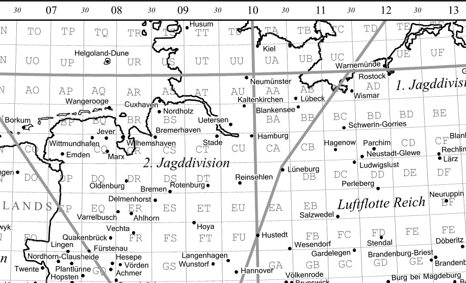
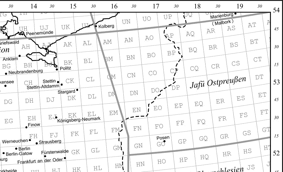
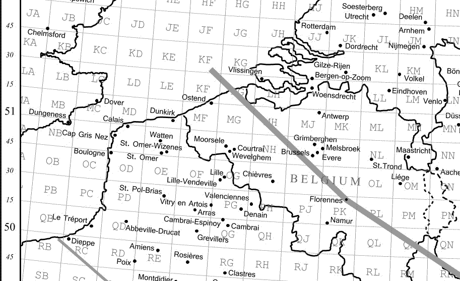
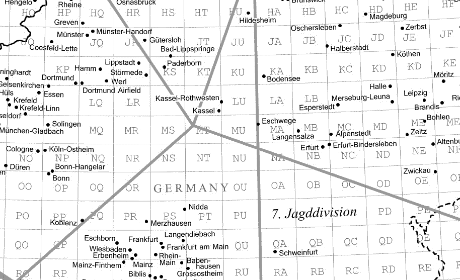
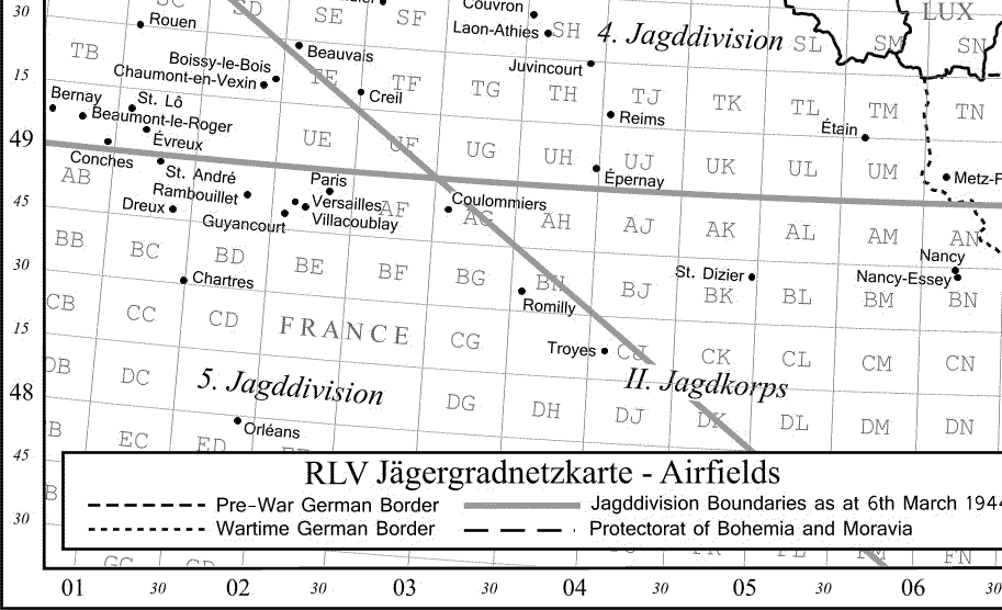
Jagdtrapez: The northern or southern half of a Zusatzzahlgebiet, which was the area enclosed by every tenth degree of latitude and longitude. The Netherlands and northwestern Germany were in Jagdtrapez 05 Ost Süd, normally abbreviated 05 Ost S.
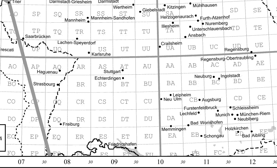
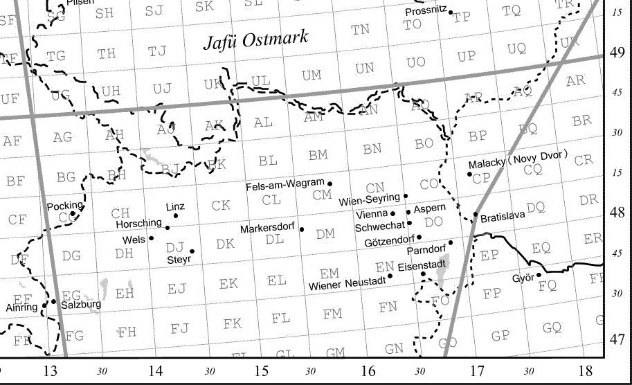
Mitteltrapez: The Jagdtrapeze were subdivided into rectangles approximately 35x28 square km along latitudinal parallels at 0', 15', 30', and 45' and the longitudinal meridians at 0' and 30'. The Mitteltrapeze were designated by two letters, increasing regularly in rows from west to east and north to south: AA, AB to AU; BA, BB, to BU; etc.
|
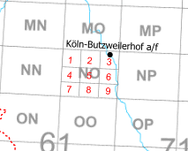
Kleintrapez:
The Mitteltrapeze were subdivided into nine rectangles, each approximately 9x11 square km, along the latitudinal parallels 5' and the longitudinal meridians 10' apart. The numbering of the Kleintrapeze ran from 1 thru 9, with 1 in the upper left corner and 9 in the bottom right corner of the Mitteltrapez.
Example
(courtesy of Andreas Brekken): Koeln-Butzweilerhof airfield was located at 05 Ost S NO-3; that is, in the northeastern corner of Mitteltrapez NO
(see right).
Two further subdivisions could be used to get down to an area of about 1x1.2 square km, but these appear very rarely in documents pertaining to the Jagdwaffe.
|
|
|
|
An example with the Kleintrapeze marked in red
|
|